Tag Archives: tourism

Larnaka gears up for summer season

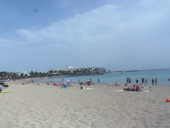
Introducing the new Vavatsinia Honeybee Trail 

With the holiday season gearing up one of the most popular areas of Cyprus is preparing to show visitors some of the areas hidden treasures.

A new bee-themed nature trail at Vavatsinia has opened which takes walkers on a 2.5km journey through the life of bees and their role in wellbeing.  ‘The Humming of the Bees’ trail combines walking in the picturesque and tranquil surroundings of mountainous Vavatsinia village with an educational and healing experience centred around the therapeutic sound of the humming of bees; something that has been proven to have health and wellness benefits. 

Vavatsinia is one of the nine Rural Larnaka Honey Villages that share a rich history of beekeeping and honey production. The route has bee-friendly plants signposted, decorative beehives and bee ‘hotels’ offering refuge for solitary bees, as well as a pavilion, benches and wooden loungers to enjoy a relaxing break. Walkers can discover interesting information on bees, such as facts about ‘apitherapy’ which uses products made by honeybees for medicinal purposes and the way in which bees communicate with flowers. Click here for more info.

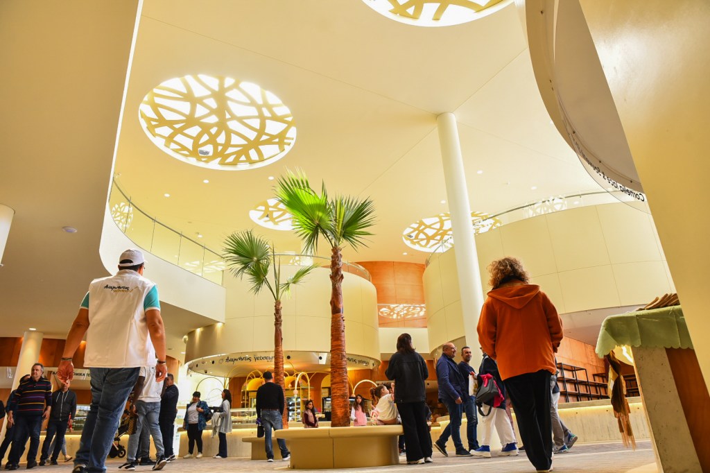
Historic Larnaka Municipal Market is re-born with new indoor market

The new Larnaka Municipal Market has opened on its original site with an indoor market throughout the week and an open-air farmer’s market on Saturdays. With the market’s long history as an integral part of Larnaka city’s fabric, the new design honours its heritage by fusing traditional elements with a contemporary structure and is set to be a landmark in the commercial centre. 

The market first opened in 1928 and operated in its original form until 1963. It remained unused for some 30 years until it was demolished at the end of the 1990s to create municipal parking. Alongside the open-air farmer’s market that operated at the site, a smaller indoor market was opened in a building across the street. 

The new market houses 20 vendors offering a variety of traditional, local produce from across the region, including stalls selling wine, dairy, cured meats, baked goods and sweets, herbal products, souvenirs and fresh fruit and vegetables. The Saturday open-air farmer’s market (from 6am – 1.30pm) offers fresh fruit and vegetables, fresh flowers and other produce. 

The new structure is a reimagined design reminiscent of the circular dwellings of the Choirokoitia Neolithic Settlement. In the future the mezzanine level will host restaurants, cafes and a snack bar, as well as cultural spaces, whilst the upper level will feature a terrace with seating area, roof garden and bars.  The market has a Facebook page that will be updated with news and events. 

Kalavasos-Tenta archaeological site ‘virtually’ reconstructed

The Kalavasos-Tenta archaeological site has been ‘virtually’ reconstructed with a historically accurate video that shows how the Neolithic settlement appeared 9500 years ago. The video takes viewers back in time to the site during the Aceramic Neolithic period (7.000-5.200 BC), when the island’s first permanent residents established a village west of the Vasilikos River plain.  

The remains of the settlement in Kalavasos village – alongside those at Choirokoitia Neolithic Settlement – are an excellent example of an early permanent settlement. The village was eventually abandoned in 5.600 BC for reasons unknown.  Watch the video here to find out more about this fascinating and sophisticated settlement. Click here for more info.

Two new ‘Talking’ statues bring history alive

Two new Larnaka Storytelling Statues have been unveiled. ‘Man with Wreath of Leaves’ at the Archaeological Museum of the Larnaka District and ‘Medieval Knight of Larnaka Castle’ are the newest members of the Larnaka Storytelling Statues family ready to narrate their unique histories. 

The Larnaka Storytelling Statues are a series of statues, busts and monuments that bear a plaque with a QR code. Once scanned users receive a call-back in English or Greek from the monument and can listen to the insightful story of each in a character narration. 

‘Man with Wreath of Leaves’ paints a vivid picture of Larnaka city during ancient times, and in particular, the areas surrounding the museum and the site of the Ancient Port of Kition. ‘Medieval Knight of Larnaka Castle’ is a noble French knight’s narration conjuring evocative images of the castle during its different eras; Byzantine, Venetian, Ottoman and British. Click here for more info.

For tourist information from the Larnaka Tourism Board, visit www.larnakaregion.com

On the Canarian landscape trail

10 Trails for enjoying Lanzarote’s natural landscapes

It may still be a foreign travel dream, but who knows? It could happen. Turismo Lanzarote has plenty to offer those looking to discover this spectacular island with this guide.

So if you are you in trail running mode or would you only put on hiking boots if we promised there’d be no sweating? Whichever you prefer, Lanzarote has the path. In this guide you will find 10 essential routes that will allow you to discover some of the most spectacular corners of the island.

Hat? Yes. Sunscreen? Yep. Fresh water? Always. Fruit, sandwich? Definitely. Mobile phone charged? One hundred percent. Okay, we’re almost ready.  

Let’s check the weather forecast, pack light but warm clothes, and take a bag for rubbish. And before setting off, we need to be clear about the following:  

  • We’re going to be moving through beautiful but fragile territory – no collecting stones, fossils or souvenir flowers.  
  • We’re going to respect nature: no litter or footprints left behind. We’ll be staying on the path. The other species on the planet will thank us for it.  
  • It’s best to hike with another person. If you do go on your own, share your planned route with someone.  

The North: cliffs, springs and crazy beaches

The sight of the Corona Volcano (609 m) from the winding LZ-201 road is impressive. It erupted twenty thousand years ago and created a volcanic tube with seventeen jameos. This route ascends to its crater from the side of the Ye hermitage, zigzagging between vines, fragrant fennel and hollyhocks. The last stretch of this 4 km path narrows and steepens slightly. Do you want to gaze into the mouth of the volcano or contemplate the view of the coast? Both panoramas will reconcile you with the world.  

Back on the LZ-201, it’s time to head towards Guinate and park the car at the first turn-off before reaching the village. The path runs between cultivated terraces and offers unique views of the Chinijo Archipelago. The Gayo springs, made of volcanic rock, are one of the few natural water sources on the island. All of them are in the Famara massif. This was one of the places where the Majos, the first settlers of the island, settled.  

We arrive at La Graciosa by ferry, have an enyesquito (snack) in Caleta del Sebo and go along a sandy track to see the beautiful Playa de las Conchas. On foot or by bike, it’s well worth the seven kilometres you need to cover to see the spectacle: the golden jable (local sand) formed by the remains of snails and seaweed, the turquoise waters (beware of the currents), the plants swollen and adapted to the salty soil and the bright colours of Montaña Bermeja.  

The heart of Los Volcanes Natural Park

This is where it all began. Before it was called Volcán del Cuervo, this was the La Lapa Mountain and it was the first to explode in 1730. A circular path allows hikers to contemplate different types of lava, seas of ash and the interior of the volcanic cone. Volcanism should be awarded the Pritzker Prize for this spectacle. You will find a car park on the LZ-56 where the trail starts. 

We continue onto the Parque Natural de Los Volcanes to look out over the largest crater on the island: the Caldera Blanca crater. No one is unmoved by this sight, which is one of the most spectacular and best preserved hydromagmatic creations in the world. In 2016, the astronaut Pedro Duque, now Spain’s Minister of Science, visited this place to learn how to identify fluids in volcanic rocks. We will also need to do this on Mars.  

Senderismo - Trekking Caldera Blanca- Turismo Lanzarote EG

The South: Papagayo and the coastline of Timanfaya  

Swimming in this paradise (Best Beach in Spain 2019, according to Condé Nast Traveler) tastes infinitely better after a walk along the backbone of the south of the island: the eroded Ajaches mountains. The trail leaves from the viewpoint of the village of Femés and follows paths opened for goat herding. You will see an incomparable view of the island of Lobos and Fuerteventura and cross a rock that bears the name of dises, hollows in the bed of a ravine that used to collect runoff water. The population used to cover them with dry branches and flat stones to prevent evaporation.  

The route along the coast of Timanfaya begins at the end of the village of El Golfo. You will see the traces of the magma’s encounter with the cool waters of the Atlantic and pass some of the island’s wildest beaches (La Madera, El Paso, Las Malvas), always enveloped in foam, broken waves and basalts. The entire route is a demanding fourteen kilometres over irregular lava areas. Special mention should be made of the Tremesana route, which requires a reservation through the Spanish National Parks Network: three gentle kilometres of volcanic structures with a guide in Spanish through the heart of Timanfaya.   

La Geria: lava and mountains  

We meet in the village of La Asomada to climb Montaña Gaida, along one of its steep, sandy slopes. First, you will see the enormous alcogida (water reservoir) that was built on the Tegoyo hill to collect rainwater. The panoramic view from the top of Gaida is spectacular: the agricultural ecosystem of La Geria, with the vines sheltered in their hollows, the Parque Natural de los Volcanes and Timanfaya. Guardilama’s height of more than 600 m also makes it an exceptional viewpoint.  

Do you feel like a glass of wine at this point? Yes, please. And you will come to understand its mineral flavour as you walk through the Juan Bello mountain, one of the epicentres of traditional viticulture on the island, where a grape variety called Diego reigns supreme, acidic, delicious and the last to be harvested. Leaving the village of La Florida behind, the path will take you to the Cueva de los Naturalistas, in Masdache, a site of geological interest with the best preserved stalactites in the whole of the Canary Islands (clusters of stone formed by the dripping of lava). We end the day eating goat’s cheese and tasting the wines of these exceptional lands in one of the wineries of the Lanzarote Designation of Origin.  

The bay of Arrecife and the eastern ravines

This was a port before it was a city, and that truth is obvious from every side. The capital of the island is a circlet of shallows, points and reefs. Our walk starts at Punta del Camello, next to the Theme Park and the bay will show us the way. If you stop for a swim at the Playa del Reducto beach, you will see the pillows of lava left here by the Maneje volcano; the route passes by the Islote de la Fermina, the Muelle de la Pescadería, the old Muelle Comercial, two bridges – Puente de las Bolas (1772) and Puente Nuevo (1920) –, the Charco de San Ginés lagoon, the Islote del Francés, Puerto Naos, the Naos salt flats, the Castillo de San José and Puerto de los Mármoles – a complete harbour route

Our last route starts from the former capital of the island, in the Villa de Teguise (Historic-Artistic Site). The path leave from the castle of Guanapay, descends through the ravines of Tejida and El Hurón to finish in a geometric landscape shaped by human activities: the rocky areas of Tinamala and Guatiza, from where red pebbles were extracted and which today are a popular location for filming video clips and movies.